Free Royalty-Free Maps You Can Download and Use for Your Personal, Commercial and Education Projects-
Free Royalty-Free Maps You Can Download and Use for Your Personal, Commercial and Education Projects-
Our free royalty-free, color, and printable maps can be downloaded for your personal, corporate, or education projects, Content License. For PC, right-click to download to your computer. For Mac, control-click and download. If you need an editable map for a PowerPoint or Adobe Illustrator project, Click Here.
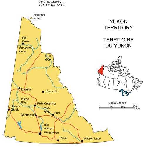
Yukon Territory, Canada Map, capital Whitehorse, includes major highways, waterways, some cities or towns, including Watson Lake, Dawson, Beaver Creek, and Faro, and a Canada location map, jpg format. Right click to download.
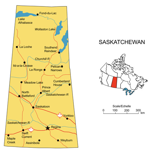
Saskatchewan, Canada Map, capital Regina, includes major highways, waterways, some cities or towns, including Saskatoon, Maple Creek Prince Albert and Weyburn and a Canada location map, jpg format. Right click to download.
© Copyright His Majesty the King in Right of Canada, Natural Resources Canada, Sa Majesté le Roi du chef du Canada, Ressources natrelies Canada 2000-2024. This is a royalty-free maps can be downloaded for your personal, corporate, or education projects. Right-click to download to your computer for PC or Control Click for Mac. The maps can not be re-sold or freely distributed. If you need an editable version for a PowerPoint or an Adobe Illustrator project, please click on the button on the right or check our editable collections.
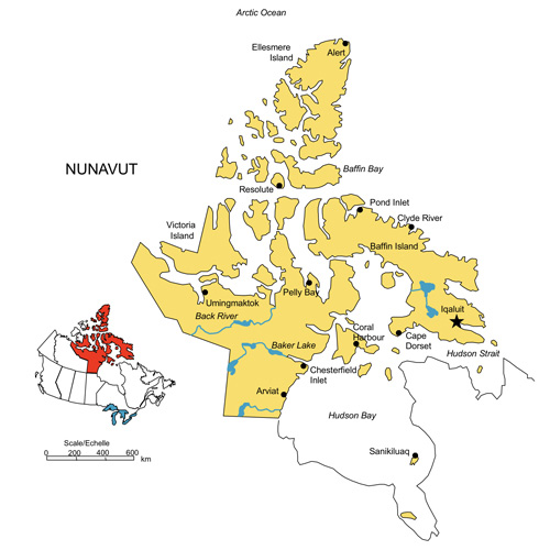
Nunavut, Canada Map, capital Iqaluit,includes major highways, waterways, some cities and towns, including Pelly Bay and Arviat and a Canada location map, jpg format. Right click to download.
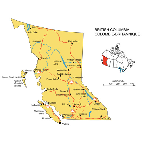
British Columbia, Canada Map, capital Victoria, includes major highways, waterways, some cities and towns, including Vancouver, Cranbrook, Port Alice and Fraser Lake and a Canada location map, jpg format. Right click to download.
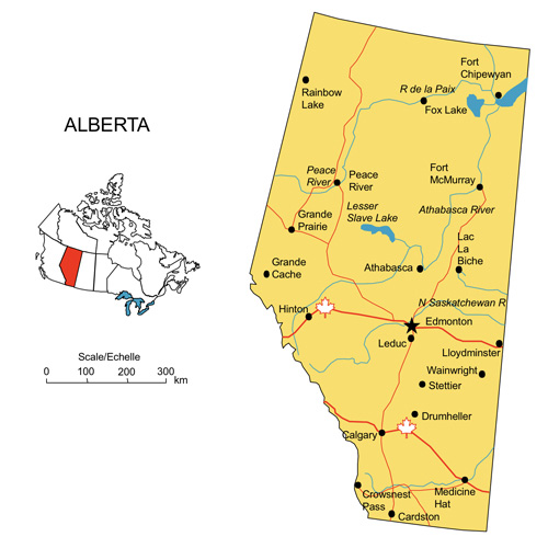
Alberta, Canada Printable Map, capital Edmonton, includes major highways, waterways, major cities, including Medicine Hat, Leduc, and Ft McMurray and a Canada location map, blank, royalty free jpg format. Right click to download.
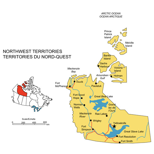
Northwest Territories, Canada Map, capital Yellowknife,includes major highways, waterways, some cities and towns, including Fort Smith, Whigley, Rae Lakes and Wrigley and a Canada location map, jpg format. Right click to download.
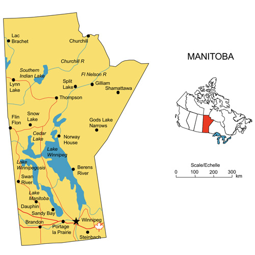
Manitoba, Canada Map, capital Winnipeg, includes major highways, waterways, some cities and towns, including Manitoba, Brandon, Steinbach and Split Lake and a Canada location map, jpg format. Right click to download.
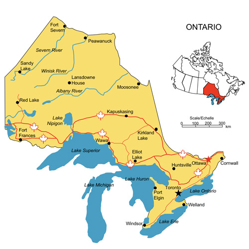
Ontario, Canada, capital Ottawa Map, includes major highways, waterways, some cities and towns, including Toronto, Windson, Fort Frances and Cornwall and a Canada location map, jpg format. Right click to download.
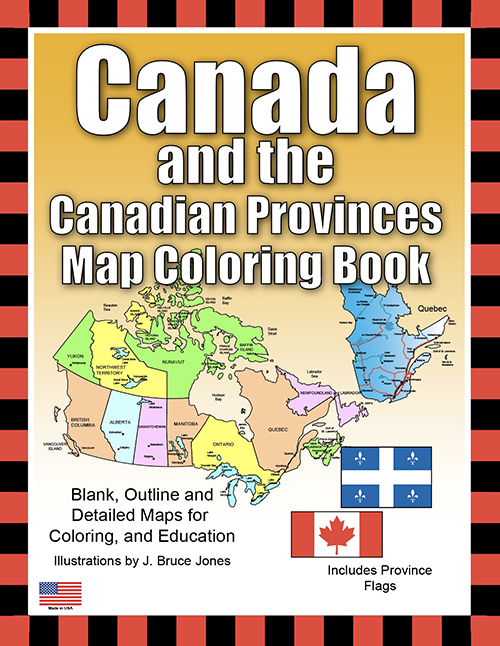
Blank, Outline and Detailed Maps for Coloring, and Education
Learn and color blank, outline maps of Canada and its Provinces and Territories along with their flags with Canada Maps, Canadian Provinces, Territories, and Flags Coloring Book. The Canada Map Coloring Book includes blank, outline maps for learning Canadian geography, coloring, home schooling, education and even making up a map for marketing. Each blank, outline Province is presented with detailed maps of political borders, capital, major cities, and towns. Each Province or Territory is broken down to 6 maps with their names and other information like highways, rivers and lakes, cites and towns, and capital.
Also included is a blank outline map without any information, which is great to color however you want. Along with each Province map is included their flag with some general information, including; Capital, Population, Size, Confederation, Motto, Bird, Flower, Tree, and a Fun Fact. Students can trace the outlines of the map, and study and highlight regions and features. A great resource for students and kids.
Includes Maps of Canada and the United States, Canada, Canada Provinces, Canadian Flag, Alberta, British Columbia, Manitoba, New Brunswick, Newfoundland and Labrador, Northwest Territories, Nova Scotia, Nunavut, Ontario, Prince Edward Island, Quebec, Saskatchewan, Yukon Territory, North America, North America Globe, United States, and each Province or Territory includes its flag.
The printable, blank, outline maps in this handbook can be freely photocopied by a teacher or parent for use in a classroom or for homeschool lessons
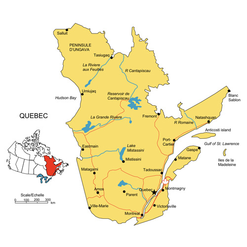
Quebec, Canada Map, capital Quebec, includes major highways, waterways, some cities or towns, including Montreal, Gaspe, Montmagny and Fremont and a Canada location map, jpg format. Right click to download.
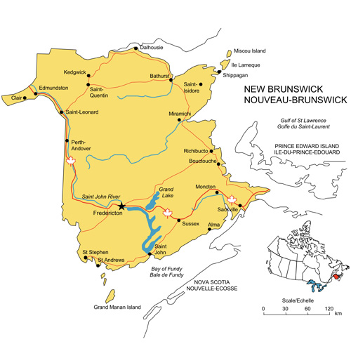
New Brunswick, Canada Map, capital Fredericton,includes major highways, waterways, some cities and towns, including St Andrews, Stint John and Alma and a Canada location map, jpg format. Right click to download.
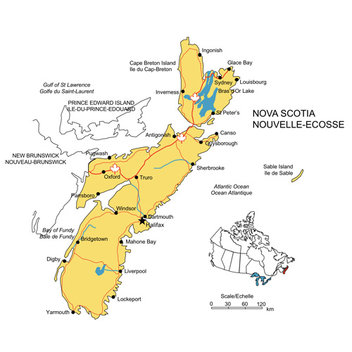
Nova Scotia, Canada Map, capital Halifax,includes major highways, waterways, some cities and towns, including Dartmouth, Sherbrooks, Yarmouth and Lockeport and a Canada location map, jpg format. Right click to download.
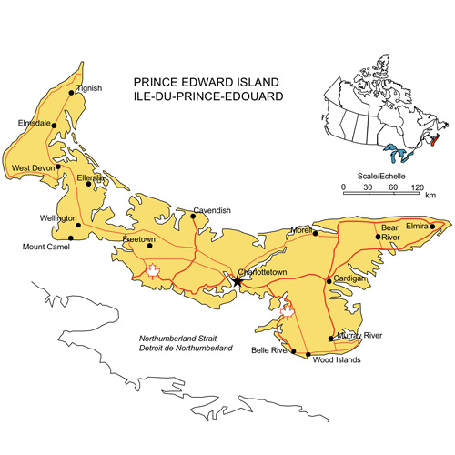
Prince Edward Island, Canada Map, capital Charlottetown, includes major highways, waterways, some cities or towns, including Freetown, Cavendish, Belle River and Mont Camel and a Canada location map, jpg format. Right click to download
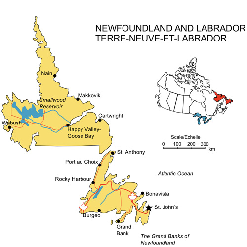
Newfoundland and Labrador, Canada Map, capital St. John’s, includes major highways, waterways, some cities and towns, including Bonavista, Grand ank, Cartwright and Rocky Harbour and a Canada location map, jpg format. Right click to download.
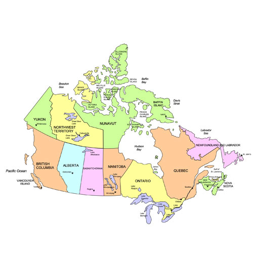
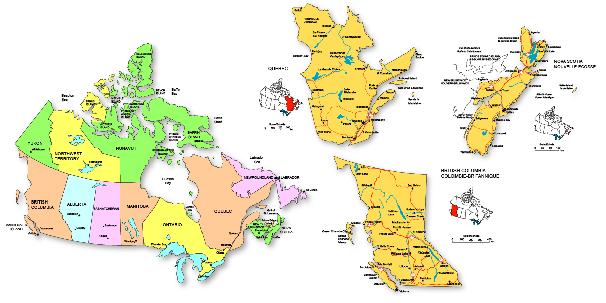
Canadia Map with Provinces and capitals, jpg format. Right click to download.
Color Clip Art Maps
Alberta Map
British Columbia Map
Manitoba Map
New Brunswick Map
Newfoundland & Labrador Map
Northwest Territories Map
Nova Scotia Map
Nunavut Map
Ontario Map
Prince Edward Island Map
Quebec Map
Saskatchewan Map
Yukon Territory Map
All 13 Canadian Province and Territory maps are filled with light yellow. Includes highways, waterways, major cities and capital.
The PowerPoint and Adobe Illustrator/EPS Maps are fully editable. PowerPoint maps are compatible with PowerPoint, Google Slides, and Apple Keynote.
State maps are made up of 4 layers; State outline, major water ways, interstate highways and major cities. Each layer is grouped together. To change an element, select the layer and ungroup it. All maps are available in editable Powerpoint, editable Adobe Illustrator and JPEG formats. Each PowerPoint file contains a slide with land and text and a slide with just the land, the Illustrator maps are set up in layers.
Free royalty-free, clip art maps for presentations, reports, education, websites, and more.
Our site includes affiliate links. If you click and purchase, we may receive a small commission at no extra cost to you. I only recommend tools I have personally vetted.
Bruce Jones Design
Mystic, CT
newtemplate.brucejonesdesign.com