Free Royalty-Free Maps You Can Download and Use for Your Personal, Commercial and Education Projects-
Free Royalty-Free Maps You Can Download and Use for Your Personal, Commercial and Education Projects-
Our free royalty-free, color, and printable maps can be downloaded for your personal, corporate, or education projects, Content License. For PC, right-click to download to your computer. For Mac, control-click and download. If you need an editable map for a PowerPoint or Adobe Illustrator project, Click Here.
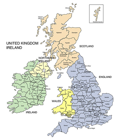
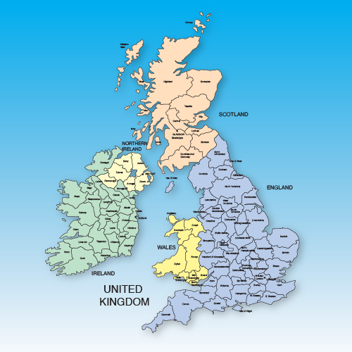
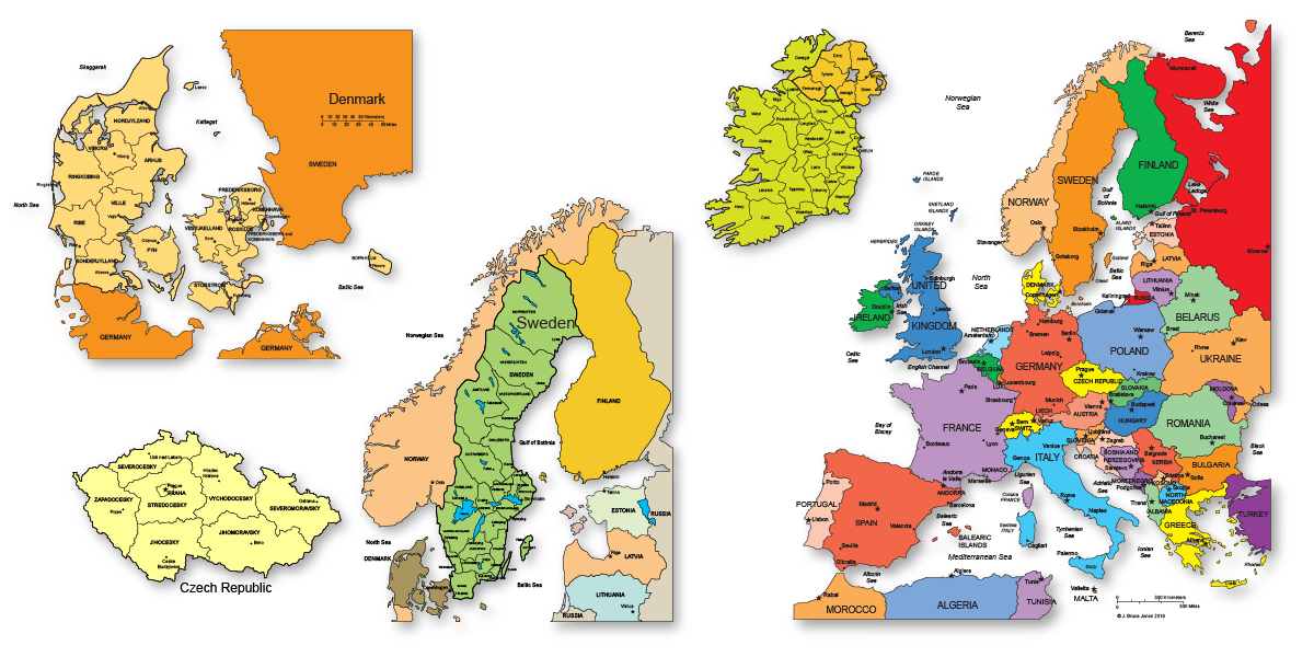
Map of United Kingdom
Map of England, Scotland, Wales, and Northen n Ireland
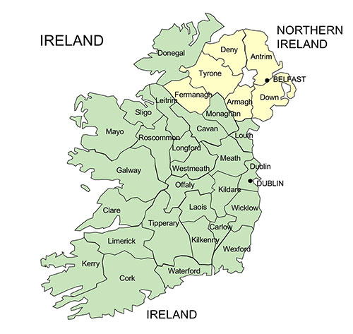
Map of Ireland and Northern Ireland
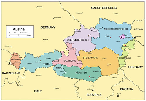
Map of Austria
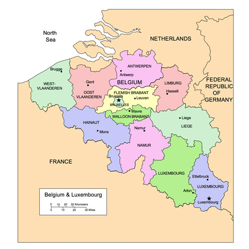
Map of Belgium and Luxembourg
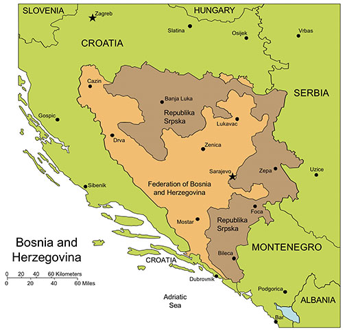
Map of Bosnia and Herzegovina
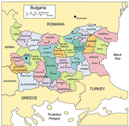
Map of Bulgaria
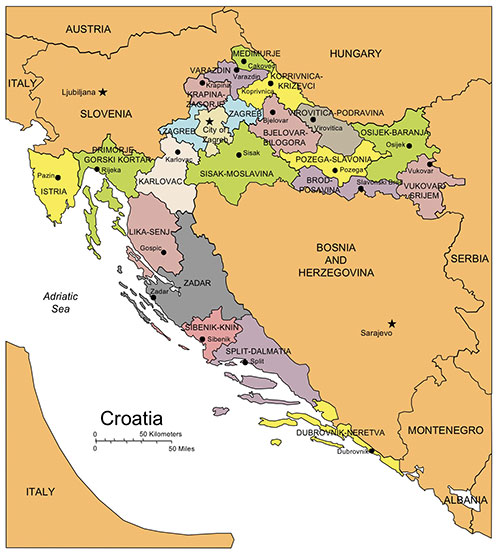
Map of Croatia
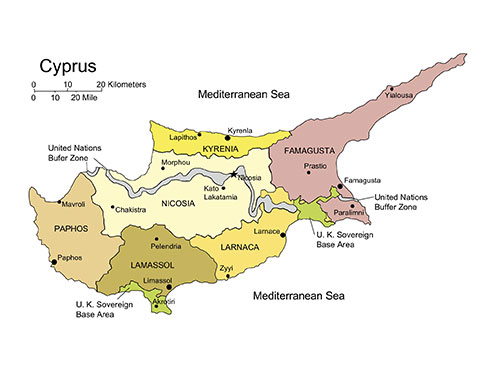
Map of Cyprus
• Maps in Color with States, District Authority or Administrative Districts, with Names.
• All elements can be edited, changed and deleted.
• Maps editable in PowerPoint and Adobe Illustrator.
• JPG maps can be customized in photo editing software.
• Maps are in color with states, District Authority or Administrative Districts, with names and capitals. All elements can be edited, changed, or deleted.
• PowerPoint and Adobe Illustrator Maps are fully editable. Our editable PowerPoint maps are compatible with MS PowerPoint, Google Slides, and Apple Keynote.
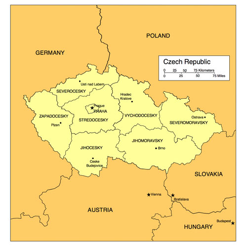
Map of Czech Republic
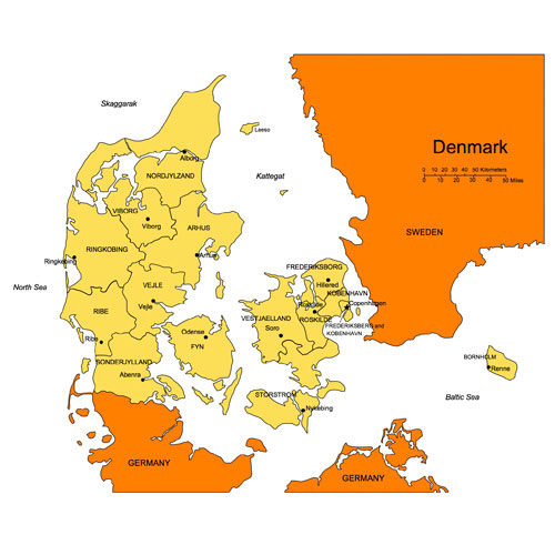
Map of Denmark
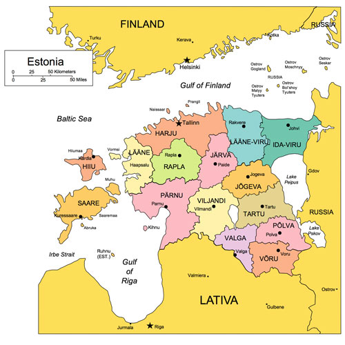
Map of Estonia
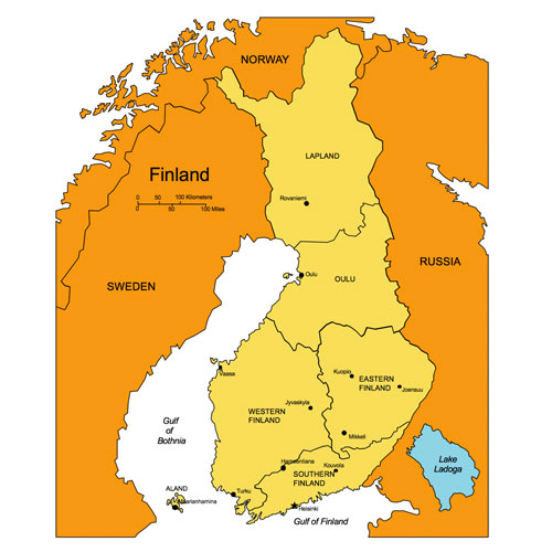
Map of Finland
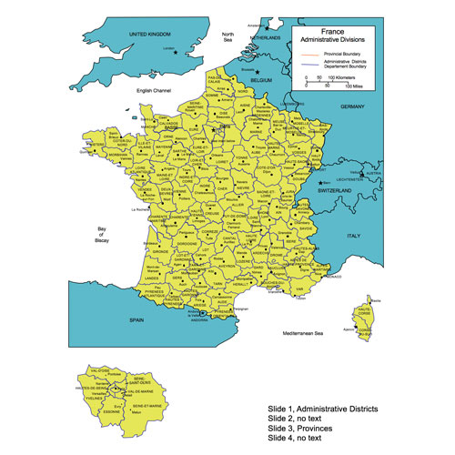
Map of France
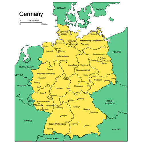
Map of Germany
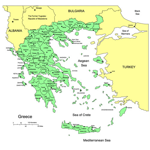
Map of Greece
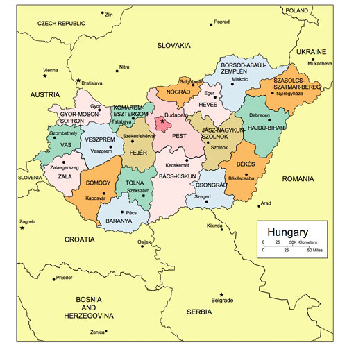
Map of Hungary
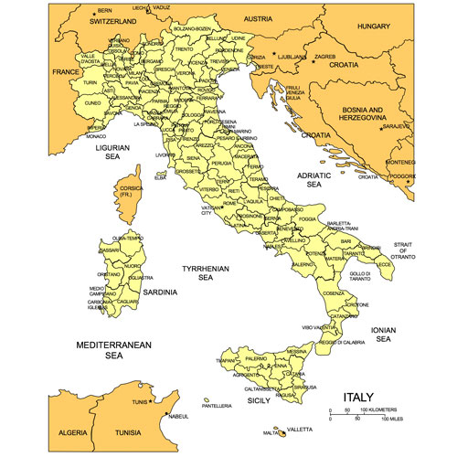
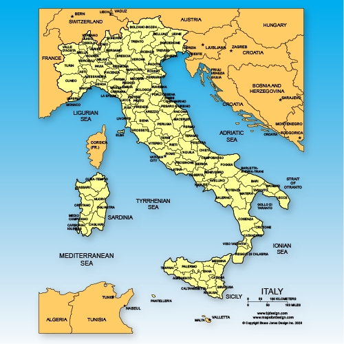
Map of Italy
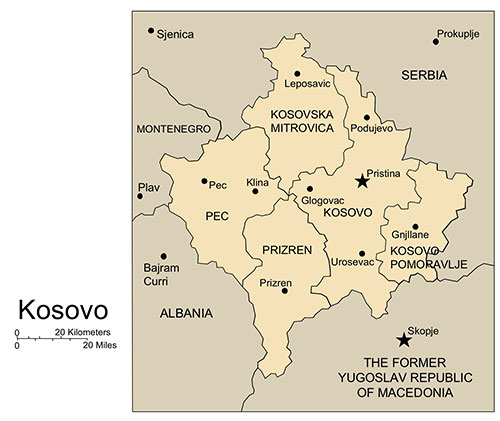
Map of Kosovo
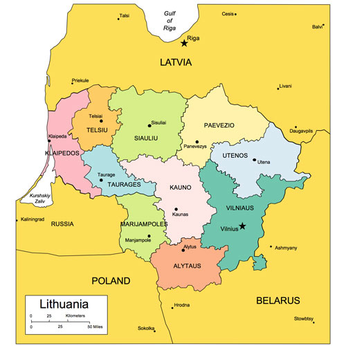
Map of Lithuania
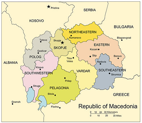
Map of Republic of Macedonia
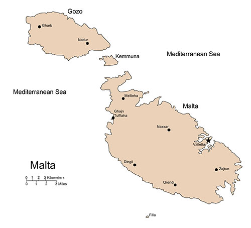
Map of Malta
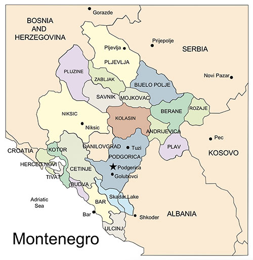
Map of Montenegro
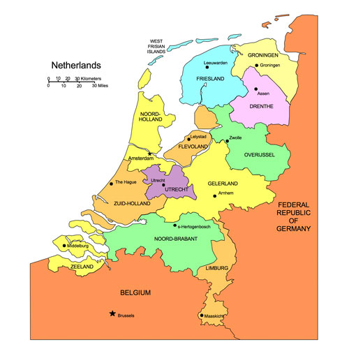
Map of The Netherlands
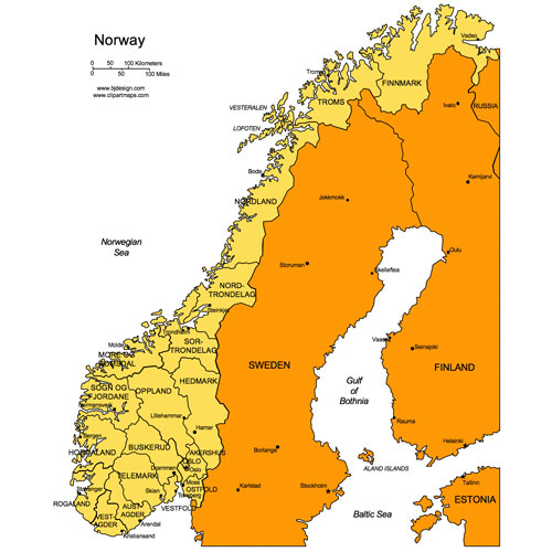
Map of Norway
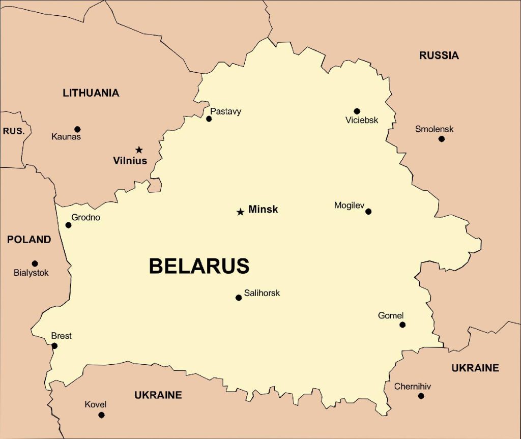
Map of Belarus

Map of Latvia
Afghanistan Map*
Antilles and Aruba Map
Argentina Map
Australia Map
Austria Map
Azerbaijan Map
Bahamas Map
Bahrain Map*
Belgium/Luxembourg Map
Bermuda Map
Bolivia Map*
Bosnia and Herzegovina Map
Brazil Map
Bulgaria Map
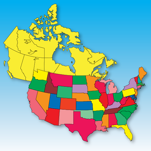
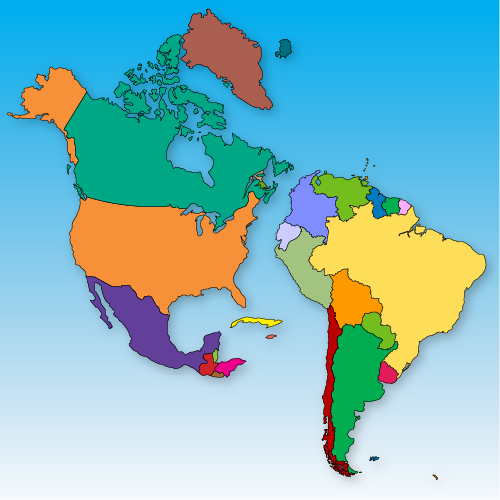
Canada Map
Caribbean Easter Island Map
Caribbean Islands Map
Cayman Islands Map
Chile Map*
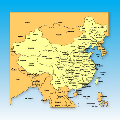
China Map
China and Region Map
Columbia Map*
Costa Rica Map
Croatia Map
Cyprus Map
Czech Republic Map
Denmark Map
Ecuador Map
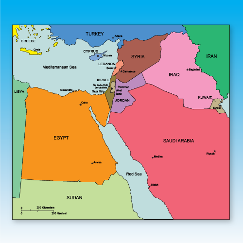
Egypt Map*
England, Ireland, Scotland Map
Estonia Map
Finland Map
France Map
Georgia Map (Country)
Germany Map
Greece Map
Hungary Map
India Map
Indonesia Map
Iran Map*
Iraq Map*
Israel Map
Italy Map
Jamaica Map
Japan Map
Jordan Map*
Kazakhstan Map
Kosovo Map
Kuwait Map*
Kyrgyzstan Map
Serbia and Kosovo Map
Singapore Map*
Slovakia Map
Slovenia Map
South Africa Map
South Korea Map
Spain/Portugal Map
Sweden Map
Switzerland Map
Syria Map*
Taiwan Map
Trinidad and Tobago Map
Turks-Caicos Map
Turkey Map
Ukraine Map*
United Arab Emirates Map
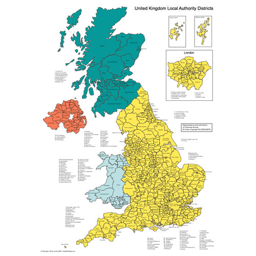
United Kingdom Map, broken down by District Authority
United States Map
Uruguay Map*
Uzbekistan Map*
West Bank and Gaza Map*
*Countries with outlines only
The PowerPoint and Adobe Illustrator/EPS Maps are fully editable. PowerPoint maps are compatible with PowerPoint, Google Slides, and Apple Keynote.
The European Country maps are made up of 2 layers; County outline and or administrative districts and major cities and capital. Each layer is ungrouped. To change an element, select the layer and ungroup it. All maps are available in editable Powerpoint, editable Adobe Illustrator and JPEG formats. Each PowerPoint file contains a slide with land and text and a slide with just the land, the Illustrator maps are set up in layers.
Free royalty-free, clip art maps for presentations, reports, education, websites, and more.
Our site includes affiliate links. If you click and purchase, we may receive a small commission at no extra cost to you. I only recommend tools I have personally vetted.
Bruce Jones Design
Mystic, CT
newtemplate.brucejonesdesign.com