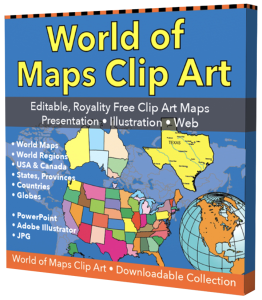
Free Royalty-Free Maps You Can Download and Use for Your Personal, Commercial and Education Projects-
Free Royalty-Free Maps You Can Download and Use for Your Personal, Commercial and Education Projects-
Our free royalty-free, color, and printable maps can be downloaded for your personal, corporate, or education projects, Content License. For PC, right-click to download to your computer. For Mac, control-click and download. If you need an editable map for a PowerPoint or Adobe Illustrator project, Click Here.
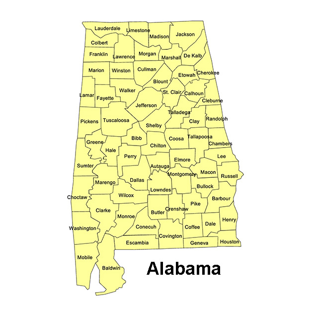
Alabama, US State County Map
County names and outlines. Printable, royalty-free, JPG format. If you need an editable version, please click on the map. Otherwise, Right-Click to Download.
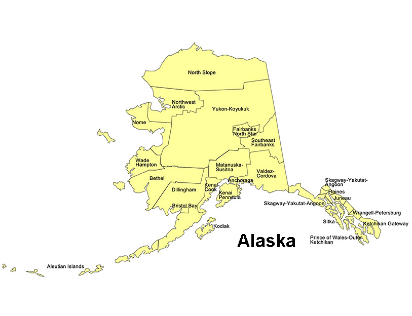
Alaska, US State County Map
County names and outlines. Printable, royalty-free, JPG format. If you need an editable version, please click on the map. Otherwise, Right-Click to Download.
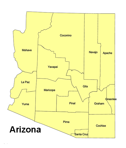
Arizona, US State County Map
Arizona State County Map, capital Phoenix, Tucson, Flagstaff, printable, royalty-free, jpg format. If you need an editable version, please click on the map. Otherwise, Right-Click to Download
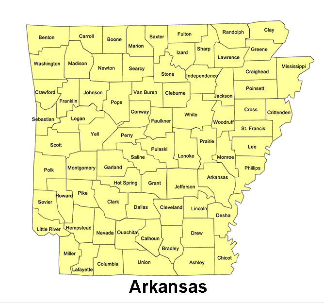
Arkansas, US State County Map
Arkansas State County Map, Capital Little Rock, Texarkana, printable, royalty-free, jpg format. If you need an editable version, please click on the map. Right-Click to Download
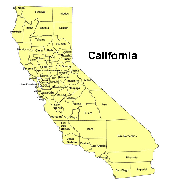
California, US State County Map
California State County Map, with names, printable, royalty-free, jpg format. If you need an editable version, please click on the map. Otherwise, Right-Click to Download.
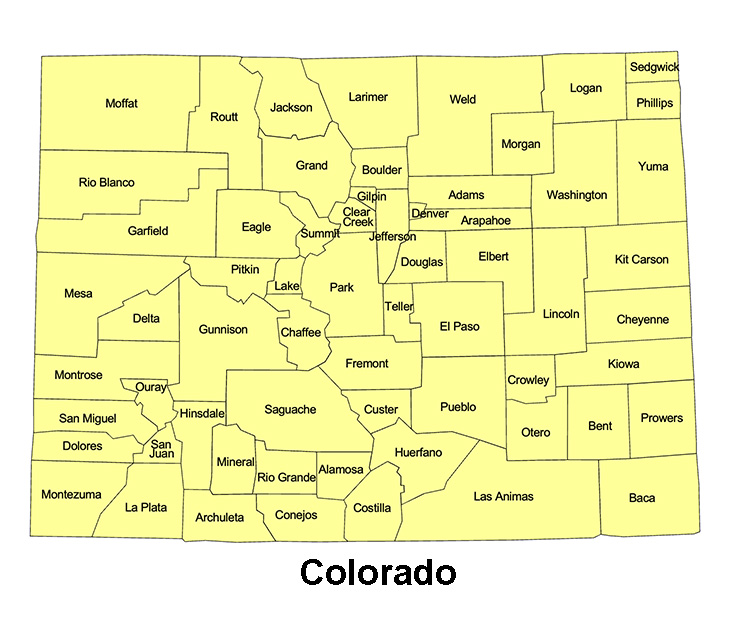
Colorado, US State County Map
Colorado State County Map, with names, printable, royalty-free, jpg format. If you need an editable version, please click on the map. Otherwise, Right-Click to Download.
Collection 1. Detailed PowerPoint state county maps contain several slides, giving you plenty of options for customizing.
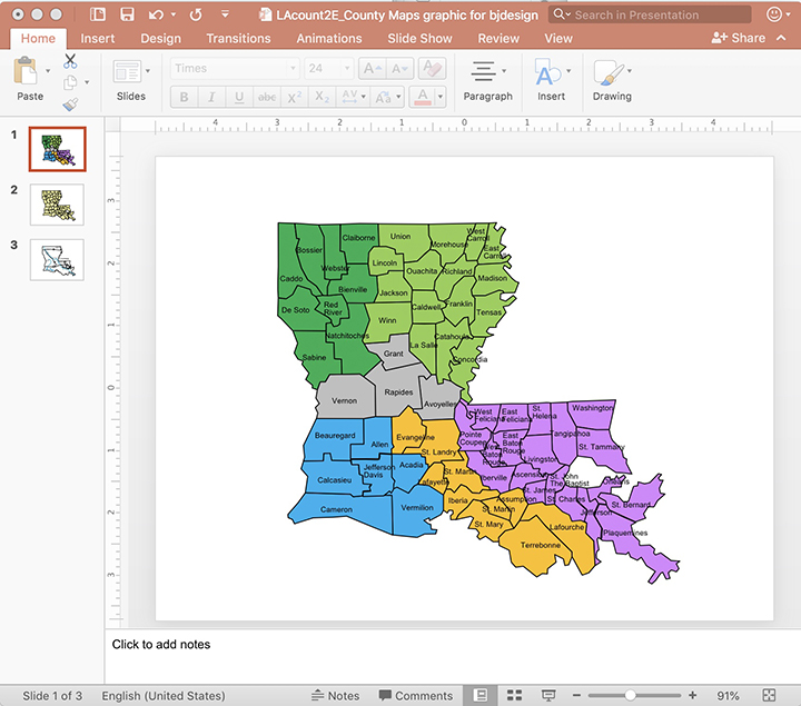
Slide 1. Editable counties and text names.

Slide 2. Each county can be edited and customized
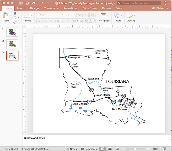
Slide 3. Contains a map with major cities, interstates, and waterways. This map can be overlaid on the others.
Editable Detailed USA County Maps for PowerPoint Sales and Marketing Presentations
• Each county map is sized to fit a PowerPoint Slide
• Every element can be colored or pulled out to show territories
• Easy to build statewide sales and marketing territories in PowerPoint
• Easy to add, change, or delete text
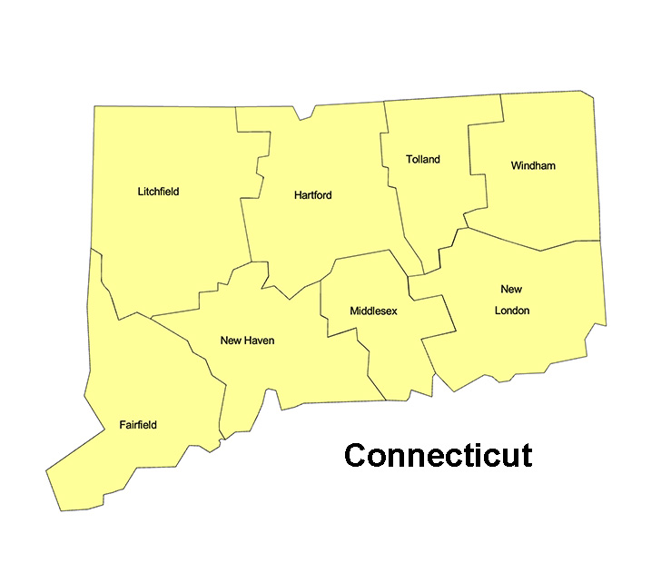
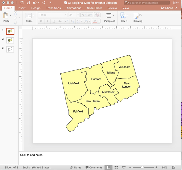
Connecticut, US State County Map
Connecticut State County Map, with names, printable, royalty-free, jpg format. If you need an editable version, please click on the map. Otherwise, Right-Click to Download.
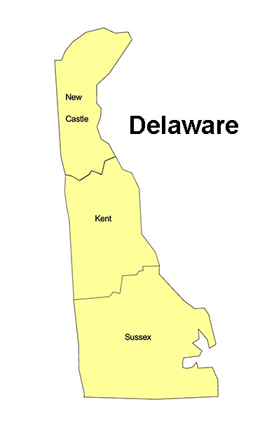
Delware, US State County Map
Delaware State County Map, with names, printable, royalty-free, jpg format. If you need an editable version, please click on the map. Otherwise, Right-Click to Download.
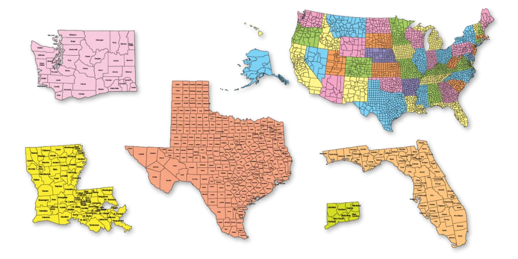
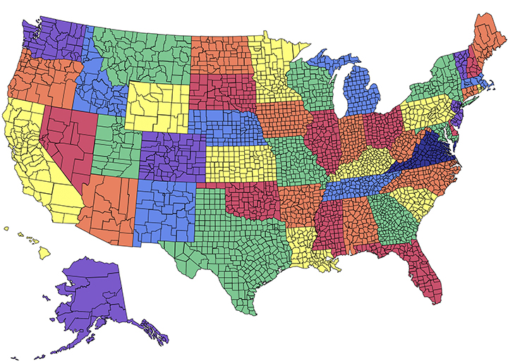
Collection 2. Regional USA County maps are designed to fit together to build a custom region.
Easy to edit, customize, or delete text and names
County maps for every state, color each county to show sales territories in PowerPoint
Build regional areas. The regional maps fit together to build custom territories
Editable Regional USA County Maps for PowerPoint Sales and Marketing Presentations
All state county maps can be fit together to form regional groups. Perfect for sales and marketing presentations. Every county in each state map is an individual element that can be colored and customized to develop sales and marketing territories. Our county maps come with county names.
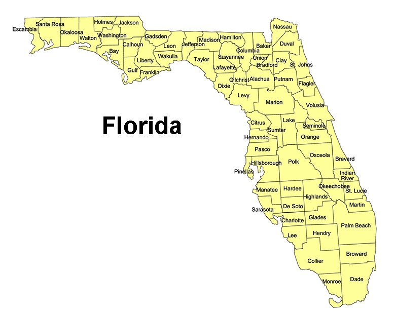
Florida, US State County Map
Florida State County Map, with names, printable, royalty-free, jpg format. If you need an editable version, please click on the map. Otherwise, Right-Click to Download.
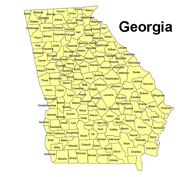
Georgia, US State County Map
Georgia State County Map, with names, printable, royalty-free, jpg format. If you need an editable version, please click on the map. Otherwise, Right-Click to Download.
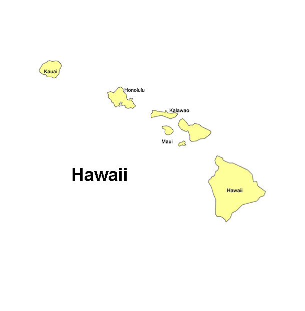
Hawaii, US State County Map
Hawaii State County Map, with names, printable, royalty-free, jpg format. If you need an editable version, please click on the map. Otherwise, Right-Click to Download.
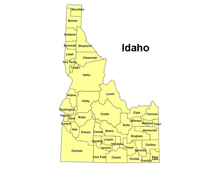
Idaho, US State County Map
Idaho State County Map, with names, printable, royalty-free, jpg format. If you need an editable version, please click on the map. Otherwise, Right-Click to Download.
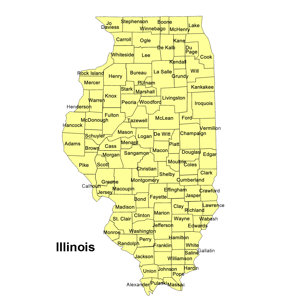
Illinois, US State County Map
Illinois State County Map, with names, printable, royalty-free, jpg format. If you need an editable version, please click on the map. Otherwise, Right-Click to Download.
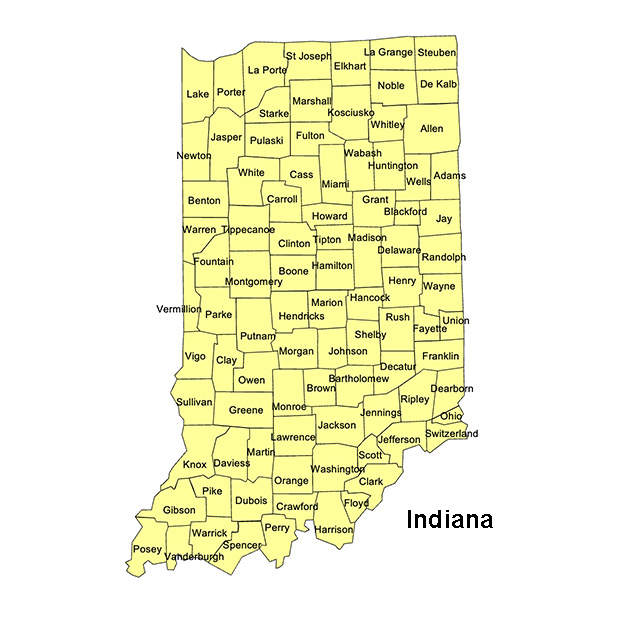
Indiana, US State County Map
Indiana State County Map, with names, printable, royalty-free, jpg format. If you need an editable version, please click on the map. Otherwise, Right-Click to Download.
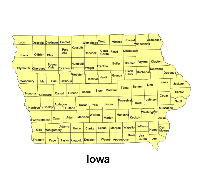
Iowa, US State County Map
Iowa State County Map, with names, printable, royalty-free, jpg format. If you need an editable version, please click on the map. Otherwise, Right-Click to Download.
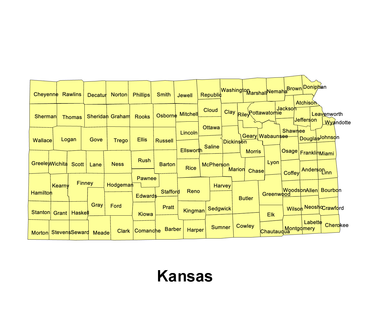
Kansas, US State County Map
Kansas State County Map, with names, printable, royalty-free, jpg format. If you need an editable version, please click on the map. Otherwise, Right-Click to Download.
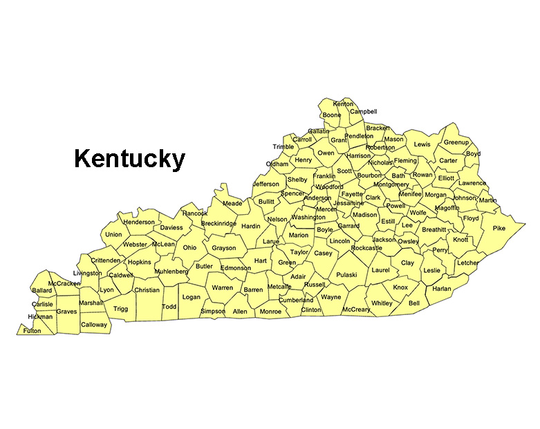
Kentucky, US State County Map
Kentucky State County Map, with names, printable, royalty-free, jpg format. If you need an editable version, please click on the map. Otherwise, Right-Click to Download.
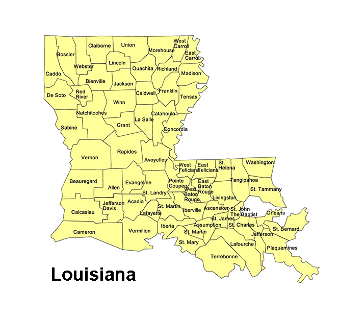
Louisiana, US State County Map
Louisiana State County Map, with names, printable, royalty-free, jpg format. If you need an editable version, please click on the map. Otherwise, Right-Click to Download.
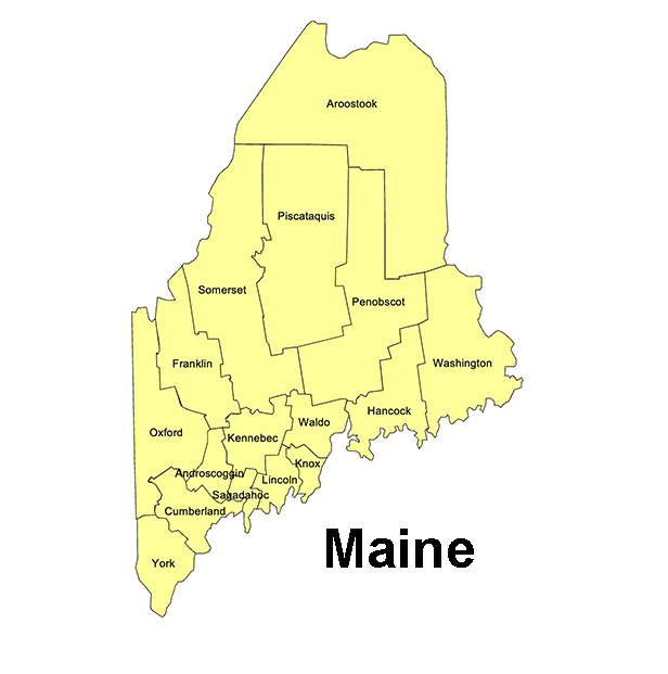
Maine, US State County Map
Maine State County Map, with names, printable, royalty-free, jpg format. If you need an editable version, please click on the map. Otherwise, Right-Click to Download.
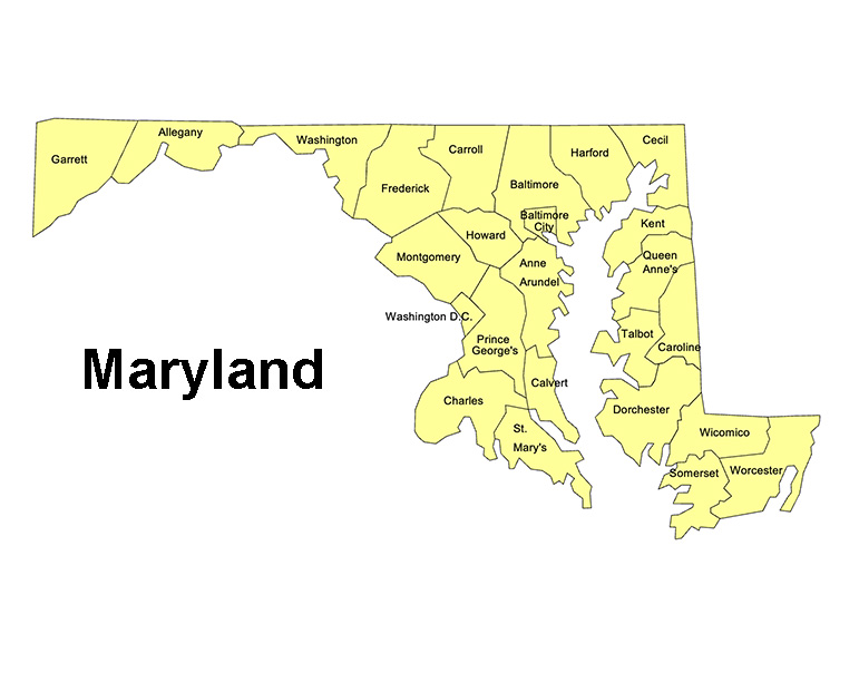
Maryland, US State County Map
Maryland State County Map, with names, printable, royalty-free, jpg format. If you need an editable version, please click on the map. Otherwise, Right-Click to Download.
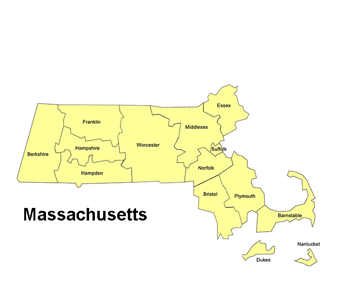
Massachusetts, US State County Map
Massachusetts State County Map, with names, printable, royalty-free, jpg format. If you need an editable version, please click on the map. Otherwise, Right-Click to Download.
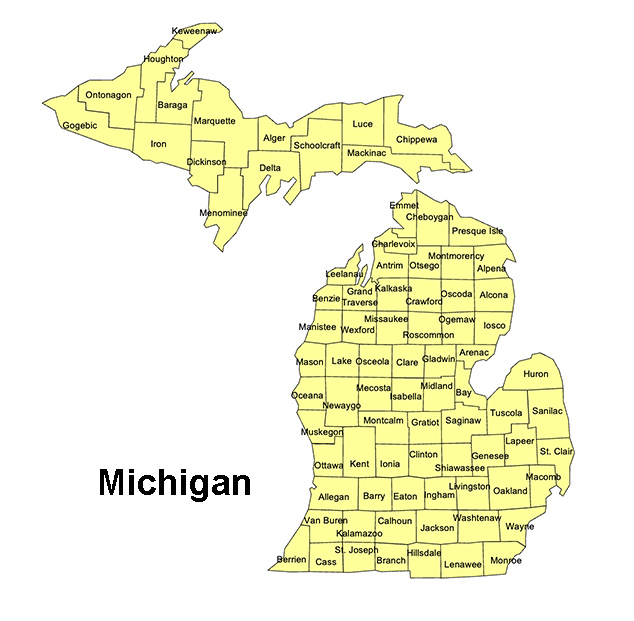
Michigan, US State County Map
Michigan State County Map, with names, printable, royalty-free, jpg format. If you need an editable version, please click on the map. Otherwise, Right-Click to Download.
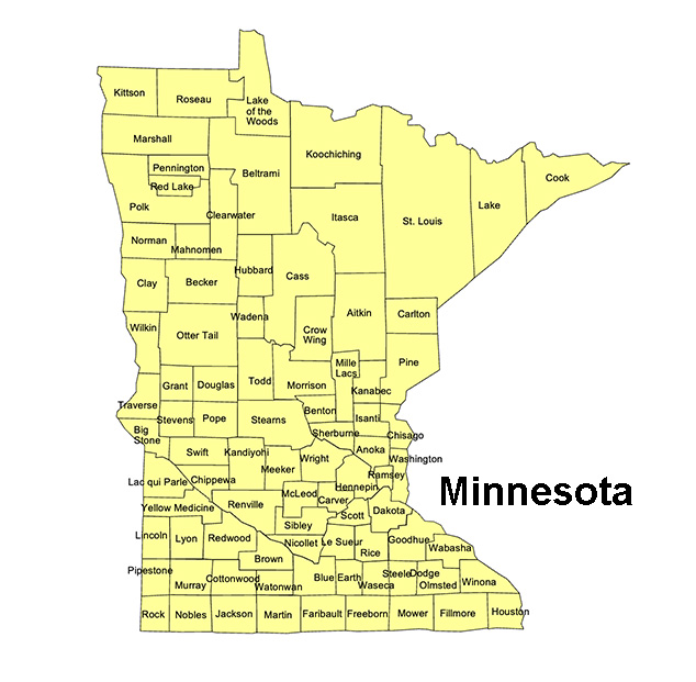
Minnesota, US State County Map
Minnesota State County Map, with names, printable, royalty-free, jpg format. If you need an editable version, please click on the map. Otherwise, Right-Click to Download.
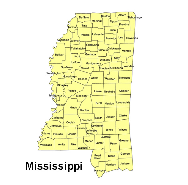
Mississippi, US State County Map
Mississippi State County Map, with names, printable, royalty-free, jpg format. If you need an editable version, please click on the map. Otherwise, Right-Click to Download.
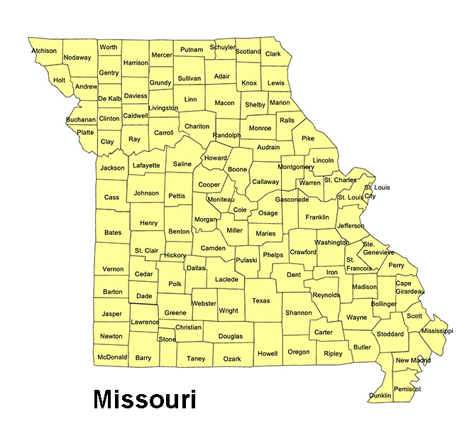
Missouri, US State County Map
Missouri State County Map, with names, printable, royalty-free, jpg format. If you need an editable version, please click on the map. Otherwise, Right-Click to Download.
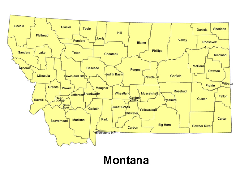
Montana, US State County Map
Montana State County Map, with names, printable, royalty-free, jpg format. If you need an editable version, please click on the map. Otherwise, Right-Click to Download.
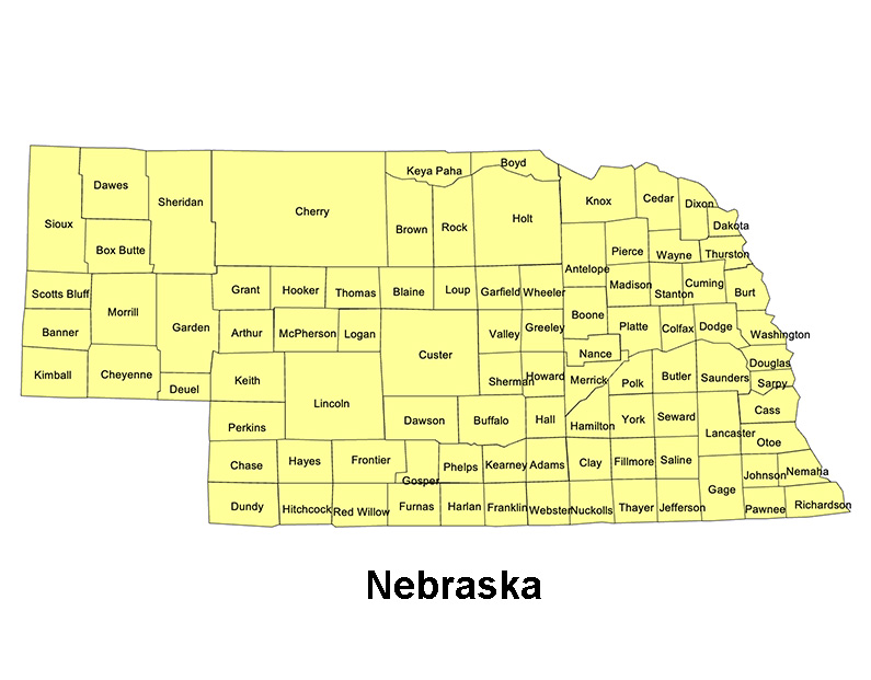
Nebraska, US State County Map
Nebraska State County Map, with names, printable, royalty-free, jpg format. If you need an editable version, please click on the map. Otherwise, Right-Click to Download.
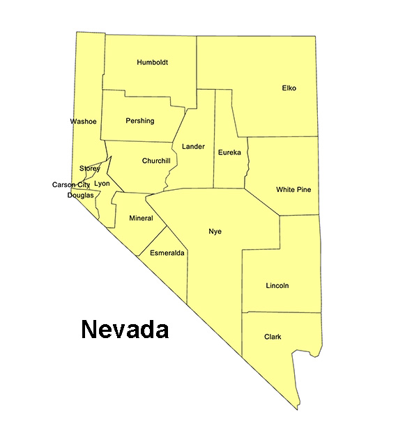
Nevada, US State County Map
Nevada State County Map, with names, printable, royalty-free, jpg format. If you need an editable version, please click on the map. Otherwise, Right-Click to Download.
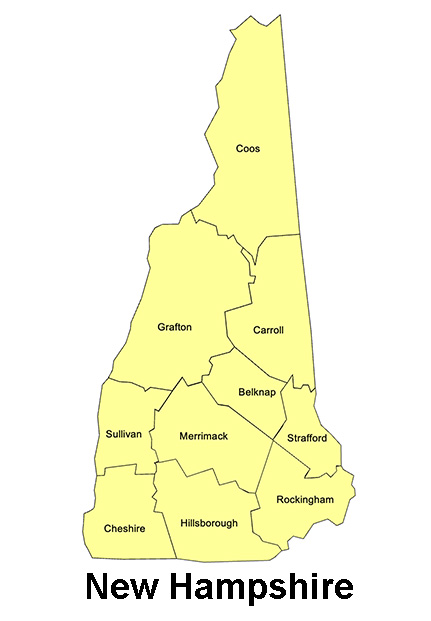
New Hampshire, US State County Map
New Hampshire State County Map, with names, printable, royalty-free, jpg format. If you need an editable version, please click on the map. Otherwise, Right-Click to Download.
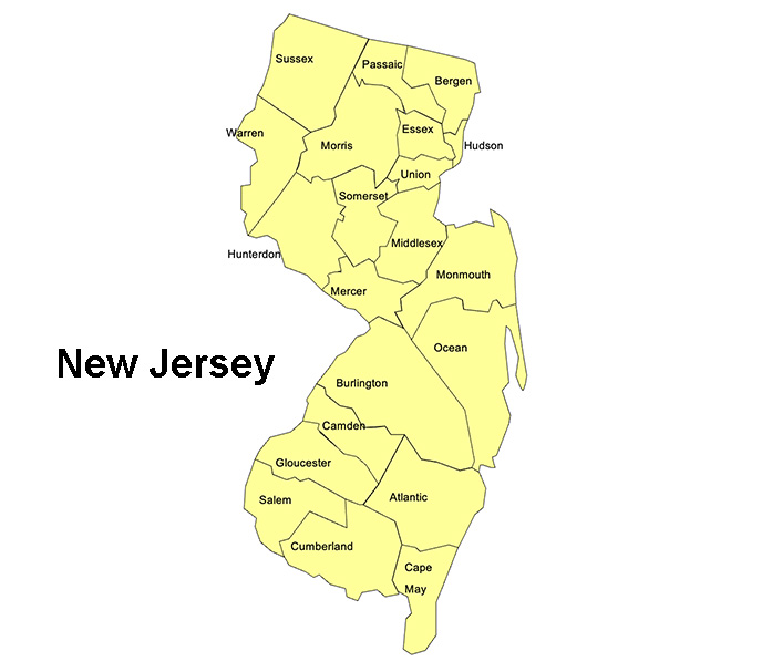
New Jersey, US State County Map
New Jersey State County Map, with names, printable, royalty-free, jpg format. If you need an editable version, please click on the map. Otherwise, Right-Click to Download.
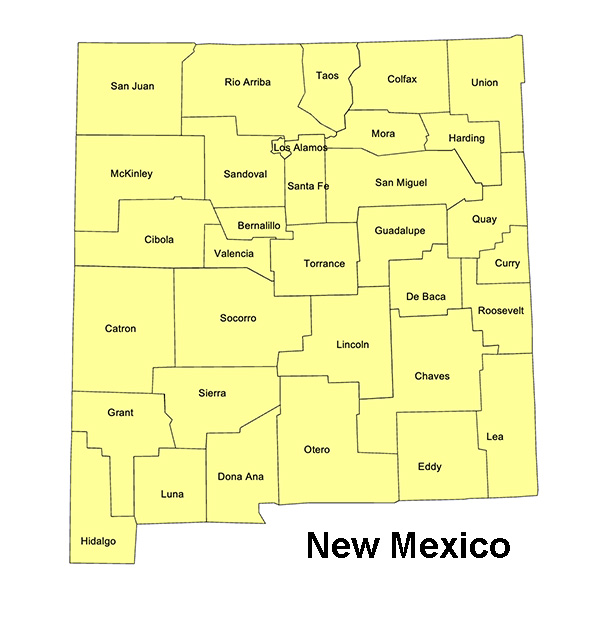
New Mexico, US State County Map
New Mexico State County Map, with names, printable, royalty-free, jpg format. If you need an editable version, please click on the map. Otherwise, Right-Click to Download.
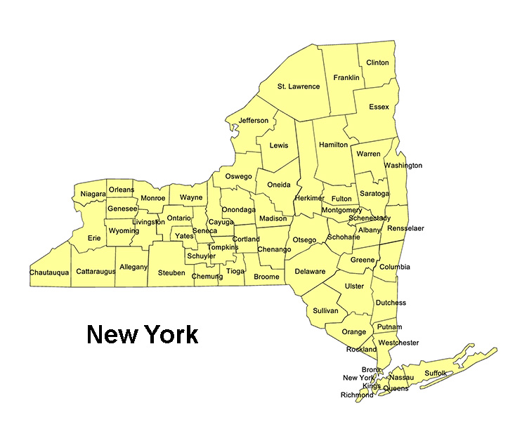
New York, US State County Map
New York State County Map, with names, printable, royalty-free, jpg format. If you need an editable version, please click on the map. Otherwise, Right-Click to Download.
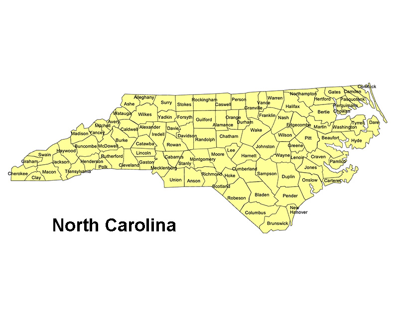
North Carolina, US State County Map
North Carolina State County Map, with names, printable, royalty-free, jpg format. If you need an editable version, please click on the map. Otherwise, Right-Click to Download.
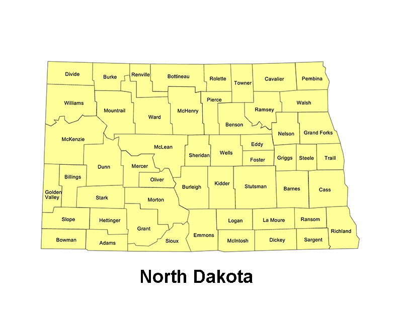
North Dakota, US State County Map
North Dakota State County Map, with names, printable, royalty-free, jpg format. If you need an editable version, please click on the map. Otherwise, Right-Click to Download.
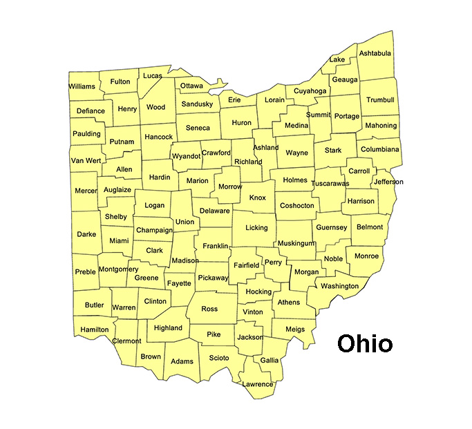
Ohio, US State County Map
Ohio State County Map, with names, printable, royalty-free, jpg format. If you need an editable version, please click on the map. Otherwise, Right-Click to Download.
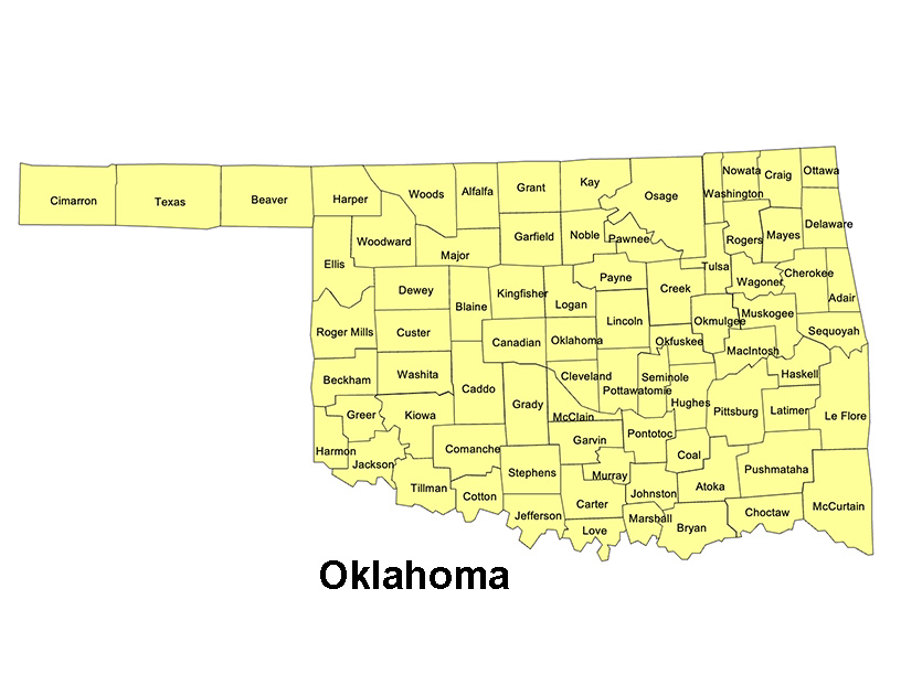
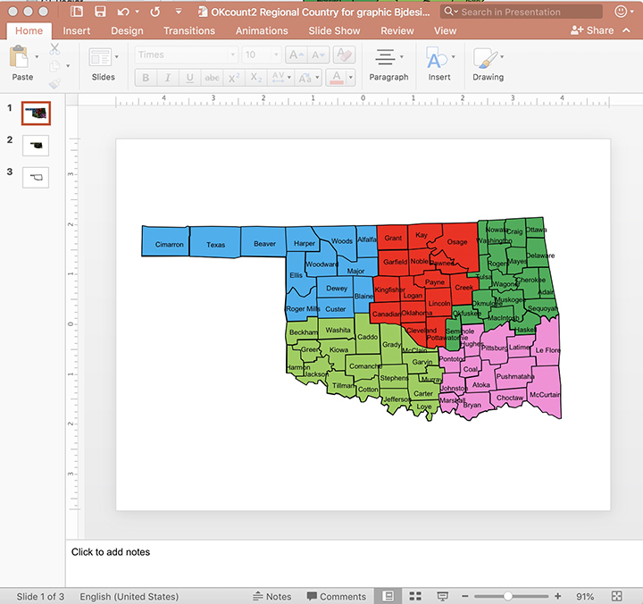
Oklahoma, US State County Map
Oklahoma State County Map, with names, printable, royalty-free, jpg format. If you need an editable version, please click on the map. Otherwise, Right-Click to Download.
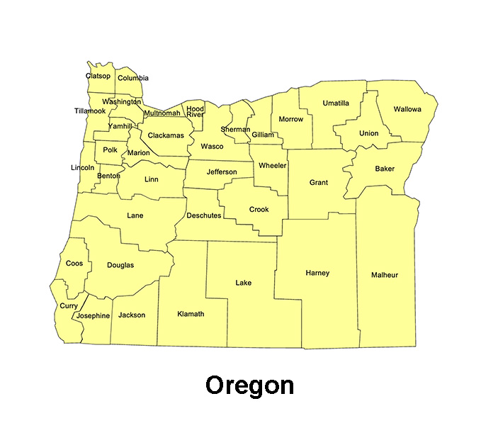
Oregon, US State County Map
Oregon State County Map, with names, printable, royalty-free, jpg format. If you need an editable version, please click on the map. Otherwise, Right-Click to Download.
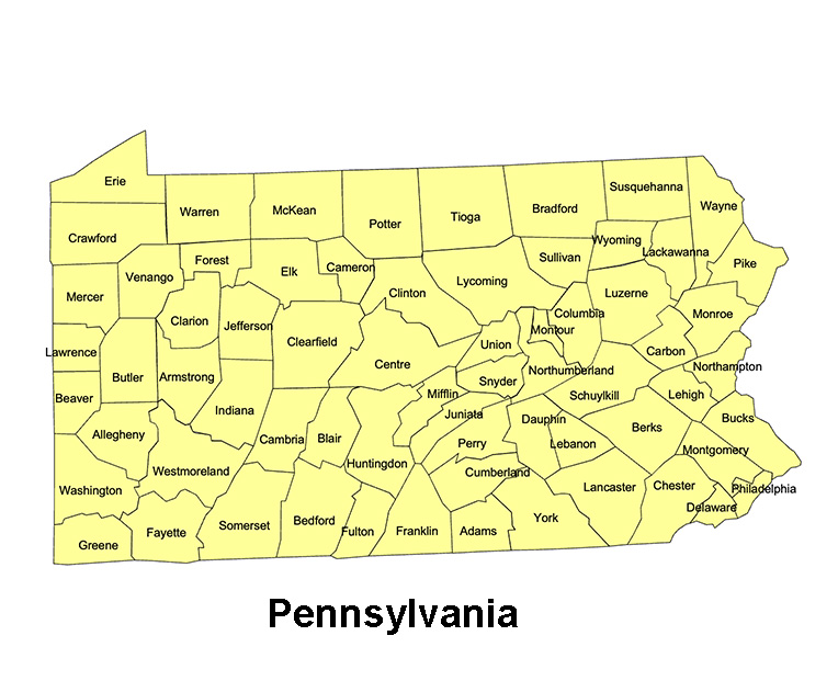
Pennsylvania, US State County Map
Pennsylvania State County Map, with names, printable, royalty-free, jpg format. If you need an editable version, please click on the map. Otherwise, Right-Click to Download.
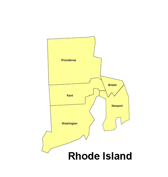
Rhode Island, US State County Map
Rhode Island State County Map, with names, printable, royalty-free, jpg format. If you need an editable version, please click on the map. Otherwise, Right-Click to Download.
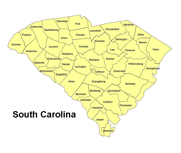
South Carolina, US State County Map
South Carolina State County Map, with names, printable, royalty-free, jpg format. If you need an editable version, please click on the map. Otherwise, Right-Click to Download.
Rhode Island, US State County Map
Rhode Island State County Map, with names, printable, royalty-free, jpg format. If you need an editable version, please click on the map. Otherwise, Right-Click to Download.
South Carolina, US State County Map
South Carolina State County Map, with names, printable, royalty-free, jpg format. If you need an editable version, please click on the map. Otherwise, Right-Click to Download.
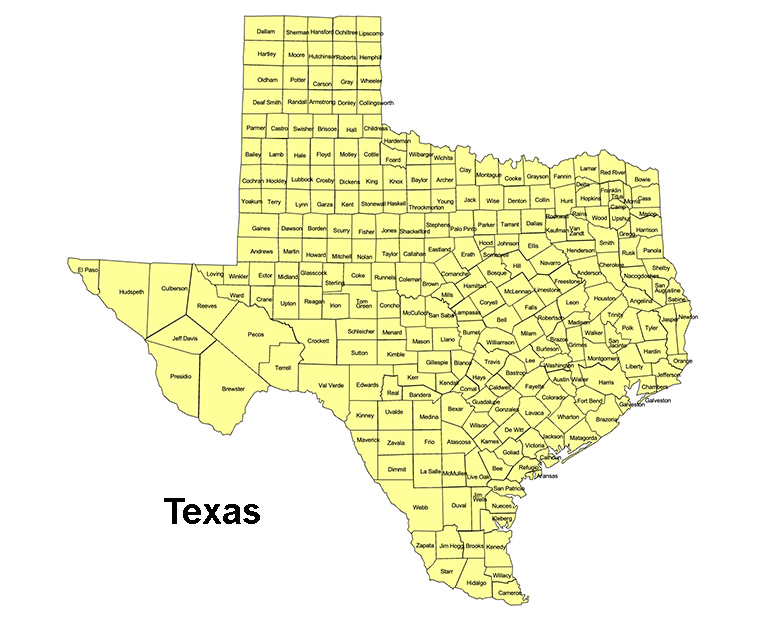
Texas, US State County Map
Texas State County Map, with names, printable, royalty-free, jpg format. If you need an editable version, please click on the map. Otherwise, Right-Click to Download.
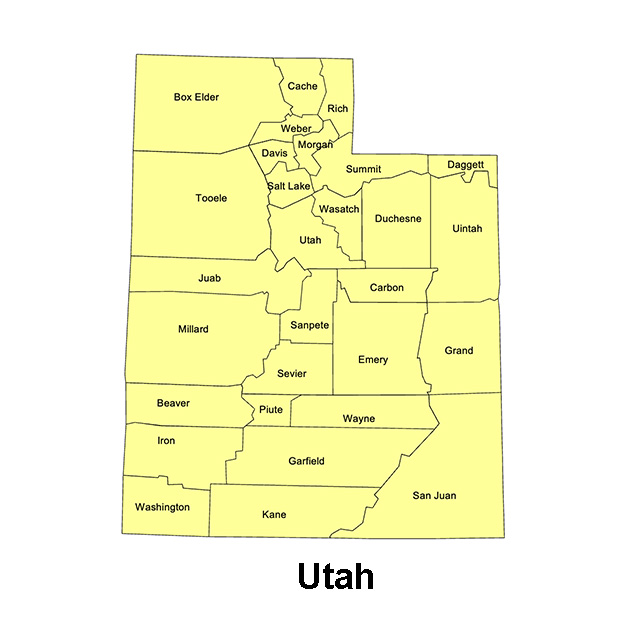
Utah, US State County Map
Utah State County Map, with names, printable, royalty-free, jpg format. If you need an editable version, please click on the map. Otherwise, Right-Click to Download.
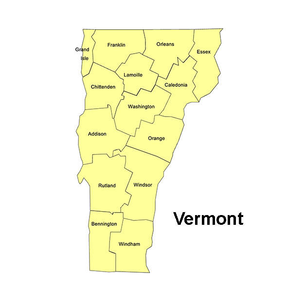
Vermont, US State County Map
Vermont State County Map, with names, printable, royalty-free, jpg format. If you need an editable version, please click on the map. Otherwise, Right-Click to Download.
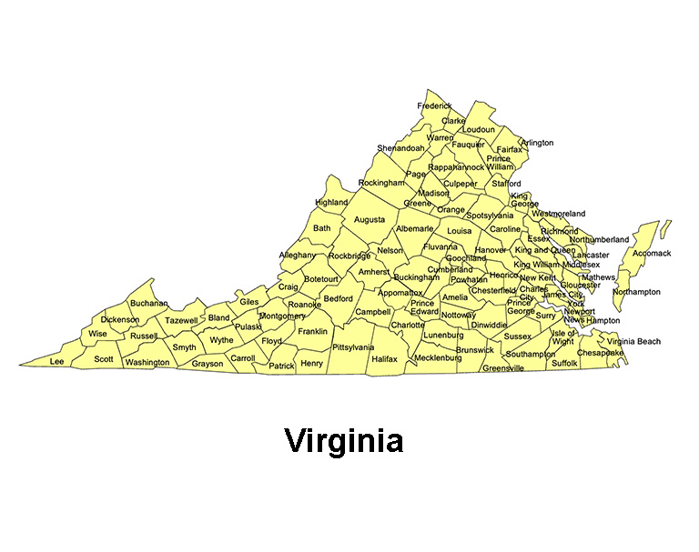
Virginia, US State County Map
Virginia State County Map, with names, printable, royalty-free, jpg format. If you need an editable version, please click on the map. Otherwise, Right-Click to Download.
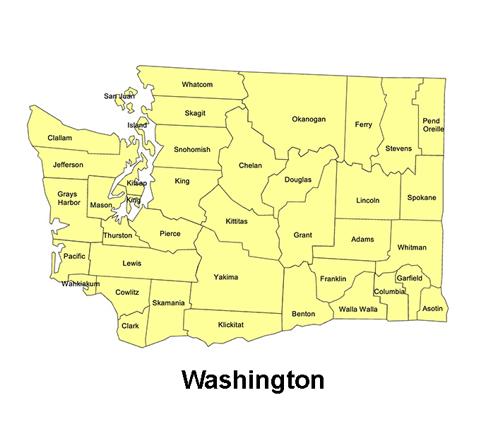
Washington, US State County Map
Washington State County Map, with names, printable, royalty-free, jpg format. If you need an editable version, please click on the map. Otherwise, Right-Click to Download.
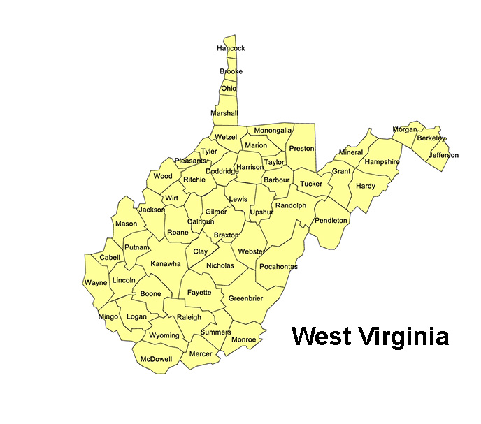
West Virginia, US State County Map
West Virginia State County Map, with names, printable, royalty-free, jpg format. If you need an editable version, please click on the map. Otherwise, Right-Click to Download.
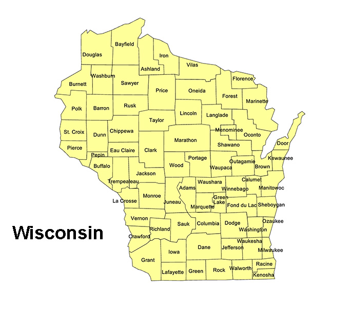
Wisconsin, US State County Map
Wisconsin State County Map, with names, printable, royalty-free, jpg format. If you need an editable version, please click on the map. Otherwise, Right-Click to Download.
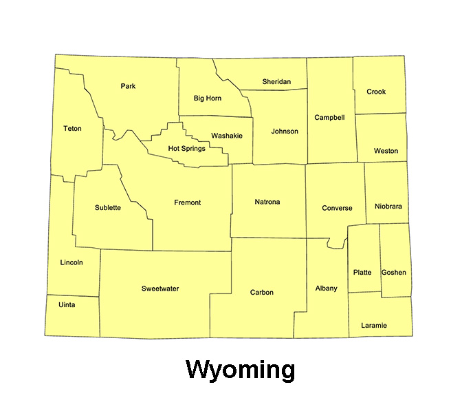
Wyoming, US State County Map
Wyoming State County Map, with names, printable, royalty-free, jpg format. If you need an editable version, please click on the map. Otherwise, Right-Click to Download.
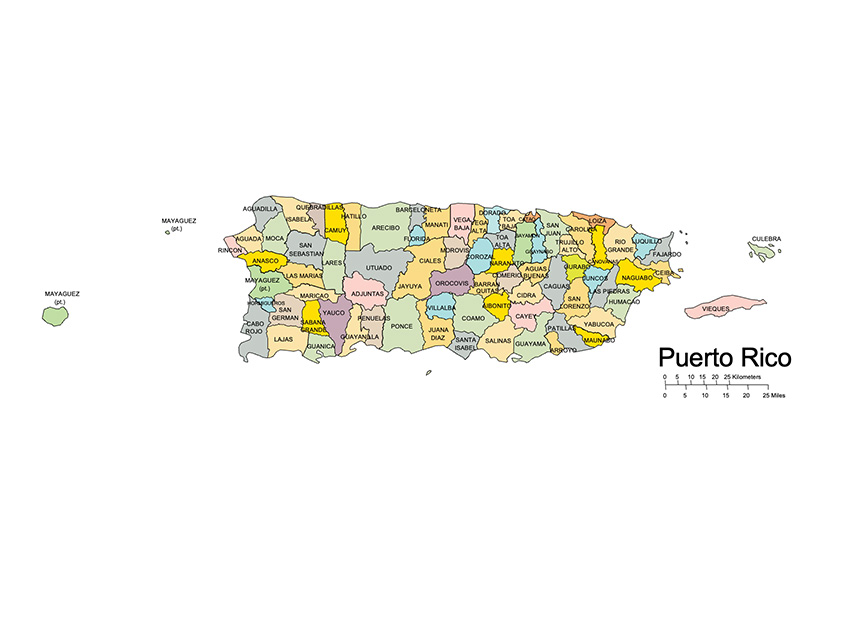
Puerto Rico, US State County Map
Puerto Rico Territory County Map, with names, printable, royalty-free, jpg format. If you need an editable version, please click on the map. Otherwise, Right-Click to Download.
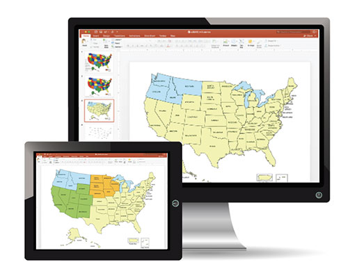
Editable PowerPoint & Adobe Illustrator US State County Map
All of our US state county maps are available in editable PowerPoint and Adobe Illustrator Format. Click on any map to learn more.
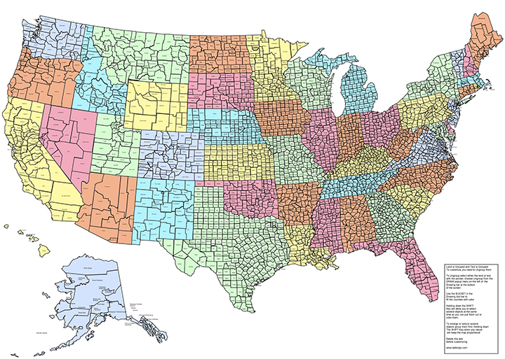
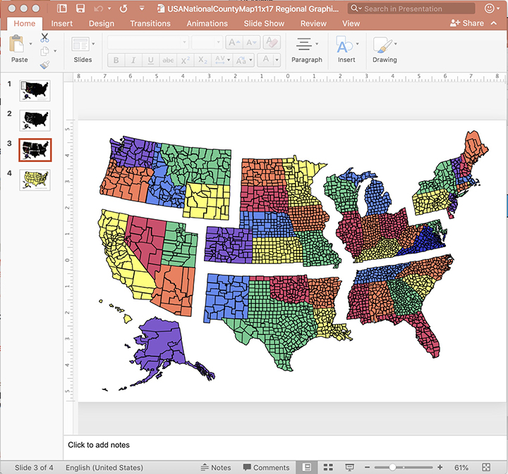
US National County Map with Names
County names and outlines. Printable, royalty-free, JPG format. If you need an editable version, please click on the map. Right-Click to Download.
US National County Map without Names
County names and outlines. Printable, royalty-free, JPG format. If you need an editable version, please click on the map. Right-Click to Download.
US National County Map with 3000+ individual editable counties, plus names. Set up on an 28″ x 20″ size PowerPoint or Illustrator document. Used for setting up national sales and marketing territories and regions. Map can be pulled apart to build a custom region.
You can build a national or regional, states, county territory sales maps with this map.
Includes 4 slides:
• All US counties plus their names
• All US counties without names
• US State borders with county name
• US State borders with state names.
Includes versions in PowerPoint and Adobe Illustrator.
Alabama Map
Alaska Map
Arizona Map
Arkansas Map
California Map
Colorado Map
Connecticut Map
Delaware Map
Florida Map
Georgia Map
Hawaii Map
Iowa Map
Idaho Map
Illinois Map
Indiana Map
Kansas Map
Kentucky Map
Louisiana Map
Maine Map
Maryland Map
Massachusetts Map
Michigan Map
Minnesota Map
Mississippi Map
Missouri Map
Montana Map
North Carolina Map
North Dakota Map
Nebraska Map
Nevada Map
New Hampshire Map
New Jersey Map
New Mexico Map
New York Map
Ohio Map
Oklahoma Map
Oregon Map
Pennsylvania Map
Rhode Island Map
South Carolina Map
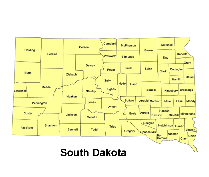
South Dakota Map
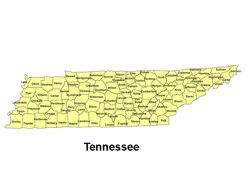
Tennessee Map
Texas Map
Utah Map
Vermont Map
Virginia Map
Washington Map
Wisconsin Map
West Virginia Map
Wyoming Map
US Territories
Puerto Rico Map
The PowerPoint and Adobe Illustrator/EPS Maps are fully editable. PowerPoint maps are compatible with PowerPoint, Google Slides, and Apple Keynote.
State maps are made up of 4 layers; State outline, major water ways, interstate highways and major cities. Each layer is grouped together. To change an element, select the layer and ungroup it. All maps are available in editable Powerpoint, editable Adobe Illustrator and JPEG formats. Each PowerPoint file contains a slide with land and text and a slide with just the land, the Illustrator maps are set up in layers.
Free royalty-free, clip art maps for presentations, reports, education, websites, and more.
Our site includes affiliate links. If you click and purchase, we may receive a small commission at no extra cost to you. I only recommend tools I have personally vetted.
Bruce Jones Design
Mystic, CT
newtemplate.brucejonesdesign.com